Drone Roof Survey and 3D Capture on Fore Street, Bodmin
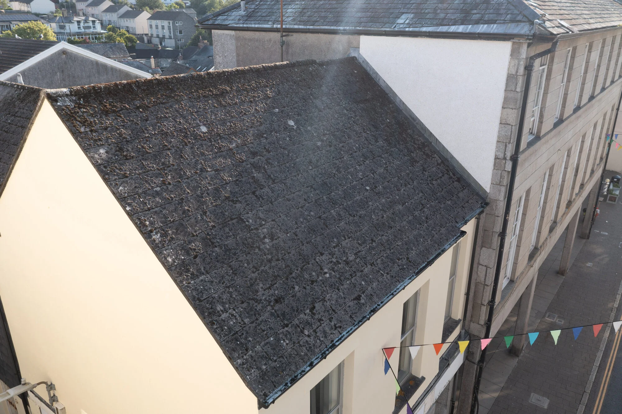
Fore Street is the heart of Bodmin, a busy high street lined with old slate-roofed buildings. This autumn I was asked to survey one of them by drone, capturing everything the client needed to build a 3D model of the property and carry out their own roof inspection.
The Brief
The client sent a detailed brief, setting out exactly how each part of the job should be flown:
- Two mapping flights. A low, close pass about 10 metres above the roof, flown as a double grid with the camera angled at -60°, and a high pass at 60 metres looking straight down over the whole area, with a lot of overlap between photos.
- Close-up photos of the whole roof. Every slope, ridge, verge and perimeter coping, the flat roofs over the side stairwells, and the full length of the gutters.
- A perimeter video, flying all the way around the property with the camera angled down towards the building.
- A 360° panorama from 15 metres above the building, supplied as the stitched image and as the single photos it’s made from.
Each part of the brief had its own job. The two mapping flights were for the 3D model, the close-ups were for the detail of the inspection, and the panorama and video were there to show the property as a whole.
The overlap in the mapping flights matters. When each photo shares most of what’s in the next one, software can match them up and build an accurate 3D model. My job was to deliver clean, consistent images. The client then built the model and completed the inspection themselves.

Planning and Safety
Most of the work on a job like this happens before I leave home. I carried out my usual pre-flight risk assessment, checked the airspace, and studied the location on Google Maps to work out where I could park and where I could safely take off and land.
Because the property sits right on the high street, the biggest risk was people walking below. To keep that as low as possible, I arrived at 8am and flew before the shops opened, while the street was still quiet.

On the Day
I used a mix of DroneDeploy for the mapping flights and manual flying for the close-ups, video and panorama. Automated flights are perfect for mapping, because the drone holds the same height, angle and overlap all the way through. Close-up roof work needs a human touch, so I can position the drone carefully around ridges, valleys and gutters.
The whole property was photographed in about 40 minutes, without any problems. Even the local seagulls left me alone, which is always a relief: gulls can be one of the biggest risks when flying over Cornish rooftops. One of them was happy to sit on the corner of the roof and watch.


What the Client Received
- Both sets of mapping photos, from 10 metres and 60 metres, which the client used to build the 3D model of the property.
- Close-up inspection photos of every roof slope, ridge, verge, coping, flat roof and gutter, giving the detail the model can’t.
- The 360° panorama, as the stitched image and the individual photos, to show the property and its surroundings.
- The perimeter video, a fly-around of the whole building, also for showing the property.
Together they give a complete record of the roof, from the whole site down to the lead work around a single window.

Why This Works for Surveyors and Property Teams
- Nobody has to go up on the roof. There’s no scaffolding, no cherry picker and no one working at height.
- There’s very little disruption. Flying early meant the job was finished before the high street got busy.
- One visit covers everything. Mapping, close-ups, video and a panorama all come from the same 40 minutes on site.
- The images work in your own software. I supply the original photos; you build the model or map the way you want.
My photos are a photographic record, not a structural, roofing or RICS building survey. A qualified roofer or surveyor should assess anything they show.
Final Thoughts
I enjoy jobs with a clear, detailed brief like this one. Knowing exactly what’s needed means I can plan every flight in advance, get it right first time, and be packed up before Bodmin’s high street wakes up.
If you need aerial records, mapping photos or 3D capture of a building, take a look at my drone surveys in Devon and Cornwall. For a single home, my drone roof inspections in Plymouth start from £150. You can also read about my drone roof survey at Duchy Hospital, Truro, or get in touch to talk about your building.
About Mike Lister
A Devon-based photographer specialising in weddings, commercial work, and drone photography. With years of experience capturing life's most important moments, Mike brings warmth, professionalism, and artistic vision to every project.
Learn more about Mike