
Drone Surveys & 3D Capture in Devon & Cornwall
Clear, safe aerial records of large or hard-to-reach buildings and sites. CAA-licensed and fully insured, with no scaffolding, cherry pickers or working at height.
Commercial surveys from £250 • 3D capture from £300
Who I Work With
A dated, high-resolution record of a building or site, without anyone needing to go up on the roof.
Surveyors & architects
Clear images of roofs, elevations and surroundings to work from, before or alongside your own inspection.
Landlords & property managers
Condition records at the start or end of a lease, and regular checks on blocks of flats and managed buildings.
Insurers & facilities teams
Annual roof inspections, gutters and plant, with photos you can file and compare year on year.
Construction
Progress records from above, so everyone can see how the site is moving along.
Please note: drone survey photos and inspection reports are a photographic record, not a structural, roofing or RICS building survey. I don’t comment on condition or annotate images. A qualified roofer or surveyor should assess anything they show.
Two Ways to Survey From Above
Choose a Commercial Survey for a clear photographic record, or 3D Capture if you want to build a model in your own software.

Commercial Drone Survey
What I do: fly the whole building or site, photographing every roof, gutter and elevation, and film a short fly-over.
What you get: edited aerial photos, a short fly-over video and commercial use rights, delivered within 5 working days.

3D Drone Capture
What I do: survey photos of the building or site, a 360° photosphere of the surroundings, and two orbit flights at different heights and camera angles.
What you get: the original, unedited images, ready for your own 3D modelling or mapping software, by download link or client portal within 5 working days.
I supply the photography only. I don’t produce the 3D model or measured drawings.
Your Interactive Drone Inspection Report
A dated record you can share with your surveyor, insurer or tenant. Every Commercial Survey comes with an interactive online report, included in the price.


Example report: a light industrial unit in Devon, 173 photos across 6 sections.
Instead of a folder of photos and a guessing game about where each one was taken, you get a map of your property split into lettered sections, with a marker for every photo and an arrow showing which way the camera was facing. Click one to see it up close, along with when it was taken and how high the drone was. You can also look around the whole site in a 360° view.
Each photo’s file name matches the full-size images I send you, so your roofer or surveyor can find the right one in seconds. You get a private online report, a PDF copy and a zip of the full-resolution images, so you can send them straight to your roofer, surveyor, landlord or insurer.
The PDF copy is handy to file with lease or insurance records, so everyone has the same dated record of the building. 3D Capture works differently: you get the original images for your own modelling software, without the report.
- See exactly where each photo was taken, section by section
- Time, camera direction and height for every photo
- Look around the whole property in a 360° view
- Share one private link, or send the PDF
- Arrives with your photos, and the online version stays up for 12 months
The report is a clear photographic record of what I could see on the day. It isn’t a structural, roofing or RICS survey, so any issues should be checked by a qualified roofer or surveyor.
Safe, Licensed, Professional
How a drone survey works, from first message to finished files
Quote & Airspace Check
Tell me the site, its size and what you need the images for. I check the airspace, weather and access, then confirm your price, usually the same day.
Flight Planning & Permissions
I plan a safe flight, register it with Altitude Angel and contact air traffic control, air ambulance teams or the landowner where needed. You don’t need to arrange anything.
Safe, CAA-Licensed Flight
I fly under my CAA Operational Authorisation with specialist drone insurance, working around your site so day-to-day operations can carry on.
Files Within 5 Working Days
Your photos and video arrive by download link, and 3D capture images by download link or client portal, within 5 working days.
Drone Survey Prices
Clear starting prices. Larger or more complex sites are quoted on size and access.
Commercial Drone Survey
For larger or complex buildings and sites
- Larger or more complex sites, quoted on size and access
- Edited aerial photos of the whole site and roof
- Short fly-over video for reports or records
- Commercial use rights, delivered within 5 working days
- A private online report, a PDF copy and a zip of the full-resolution images
3D Drone Capture
For surveyors, architects and construction firms
- Survey photos of the building or site
- 360° photosphere of the surroundings
- Two orbit flights at different heights and camera angles
- Original, unedited images for your own 3D or mapping software, delivered within 5 working days
Optional Add-ons
Add these to a survey or 3D capture where you need them.
Fly-over video
A short fly-over video is included with every Commercial Survey, so there’s nothing extra to pay.
Inspection report
Every Commercial Survey comes with a private online report, a PDF copy and a zip of the full-resolution images. The online report plots every photo on a map and stays up for 12 months. 3D Capture gives you the original images instead.
Airspace permissions
Air traffic control, airfield, hospital or landowner permissions for restricted sites.
Drone add-on to a photoshoot
Up to 15 minutes of flying during a commercial or property shoot, with 10–15 edited aerial photos in the same gallery.
Travel within 1 hour of Plymouth is included; beyond that, travel is 45p per mile. Just need a single home checked? See my drone roof inspections, from £150.
Drone inspection photos and reports are a photographic record, not a structural, roofing or RICS building survey. I don’t comment on condition or annotate images. A qualified roofer or surveyor should assess anything they show. See my terms.
Recent Surveys
How a drone survey works in practice, from planning to delivery

Drone Roof Survey at Duchy Hospital
A full day photographing every roof on a busy hospital site, planned with Cornwall Air Ambulance so the drone was grounded whenever a helicopter came in.
Read the case study →
Annual Gutter Inspection at Victoria House
A yearly roof and gutter inspection for a block of flats, required by the building’s insurer, with the management company watching live as I fly.
Read the case study →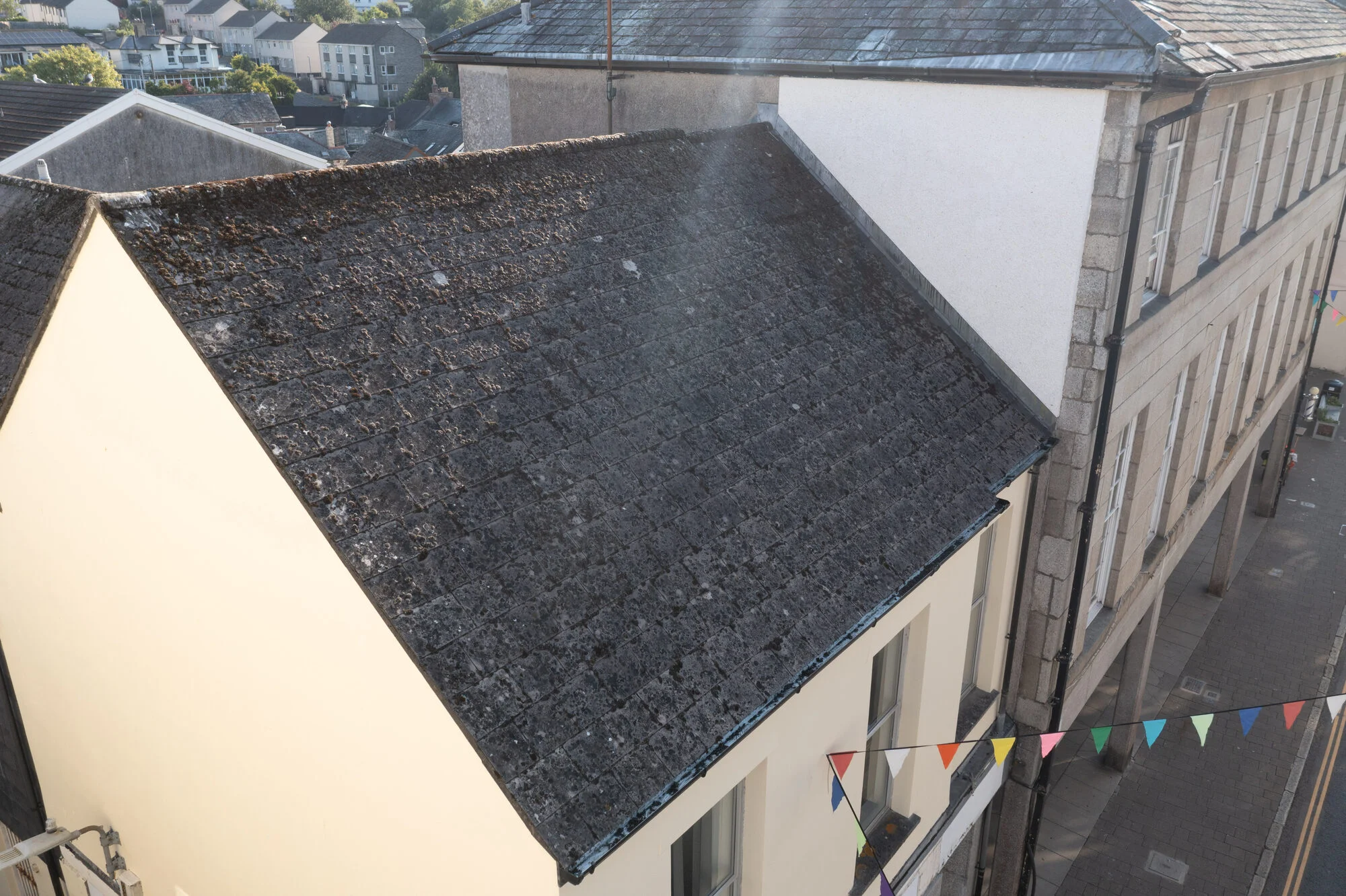
Drone Survey and 3D Capture on Fore Street
Mapping flights, close-up roof photos, a perimeter video and a 360° panorama of a high street property, all captured in 40 minutes before the shops opened.
Read the case study →Planning a Survey?
Tell me about the site and what you need the images for. I’ll check the airspace and come back to you with a clear price.
CAA Licensed • Fully Insured • Devon • Cornwall • Plymouth
Drone Survey Questions
Common questions about drone surveys and 3D capture in Devon and Cornwall
Ready to Start Your Story?
Whether you're planning a wedding, need professional business photography, or want breathtaking aerial shots - I'm here to help bring your vision to life.
Get in Touch
I usually reply the same day, and always within 24 hours.
Please try again or email me directly.