Salkantay Trek Days 3 & 4: Llactapata to Aguas Calientes
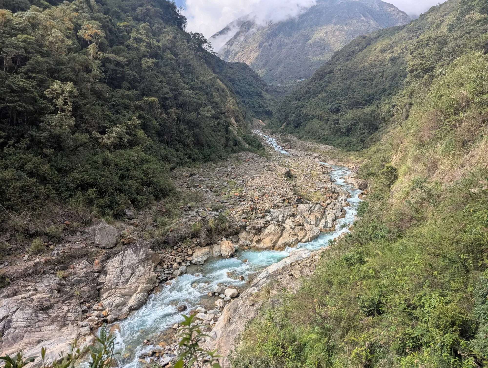
By Day 3 of the Salkantay Trek, the landscape had completely changed.
The snow-covered mountains around Salkantay Pass were behind us and we were heading deeper into greener valleys, following rivers, visiting local plantations and gradually making our way towards Machu Picchu.
Day 3 gave us a chance to recover.
Day 4 did not.
Our itinerary showed approximately 25 km of walking on Day 4, including the climb towards Llactapata, a section we’d heard referred to as the Gringo Killer, a long descent and then the final walk beside the railway towards Aguas Calientes.
It was one of the longest and most physically demanding days of our Salkantay Trek.
It was also the only day I managed to record properly on Strava, which means I can compare the advertised distance with what I actually recorded.
This is what Days 3 and 4 were really like.
For the complete route, start with my:
Salkantay Trek to Machu Picchu: My Honest First-Hand Guide
Day 3: Into the Jungle
Sunday 11 October 2026
After the long climb and descent across Salkantay Pass the previous day, Day 3 felt considerably more relaxed.
We woke at around 5.30am with mist sitting around the mountain tops.

The environment was now completely different from the exposed mountains we’d been walking through only a day earlier.
We followed the trail down towards the river, surrounded by increasingly green vegetation.
This change in landscape was one of the things I enjoyed most about the Salkantay route.
It didn’t feel as though we were walking through the same environment for five days.
Passion Fruit Straight from the Plantation
At around 8.59am, we reached a passion-fruit plantation.
We stopped there and had fresh juice before continuing along the trail.
It was a small part of the day, but exactly the sort of experience that makes a multi-day trek more interesting than simply walking from one camp to another.

Visiting a Peruvian Coffee Plantation
By around 11am, we’d reached a coffee plantation.
Here we learnt more about coffee grown in Peru and saw the process of preparing the beans.
We watched them being roasted and ground before making coffee ourselves.

After two days where most of my attention had been focused on mountains, altitude and putting one foot in front of the other, it was nice to have a completely different experience.
We then travelled onwards and reached our accommodation in the basin of the valley at around 12.20pm.
Lunch was at approximately 1pm.
And then something unusual happened.
We had a free afternoon.
Hot Springs or an Afternoon Off?
There was an optional trip to the hot springs for anyone who wanted to go.
There was an additional charge for the visit and transport.
Alternatively, you could stay at the accommodation and relax.
One thing I learnt during the trek was that you don’t necessarily need to say yes to every optional activity.
Sometimes sitting down and giving your legs a rest is an activity in itself.
Especially when you know what is coming the following morning.
Day 4: The Gringo Killer
Monday 12 October 2026
Day 4 had been talked about before we reached it.
Our itinerary described approximately 25 km of walking, with an expected trekking time of around eight to nine hours.
Part of the climb had also acquired the nickname the Gringo Killer.
We were staying in the basin of the valley.
That meant the morning started with one obvious direction.
Up.
Climbing Out of the Valley
The climb was very different from Salkantay Pass.
By this point we already had three days of walking in our legs, and much of the route involved uneven steps.
I found those steps particularly tiring.
Rather than settling into a normal walking stride, you’re repeatedly lifting your legs higher and adjusting where you put your feet.

By around 9am, we’d reached the top.
We stopped there and learnt about the old storehouses in the area before beginning the descent.
It was also a chance to look back across the valley we’d just climbed out of.
My Actual Strava Recording
Day 4 was the only day where I managed to record the walking properly on Strava.
That turned out to be useful because it gives me something more reliable than trying to remember the distance afterwards.
My morning recording showed:
| Day 4 morning | Strava |
|---|---|
| Distance | 13.47 km |
| Elevation gain | 1,094 m |
| Moving time | 3 hrs 19 mins |
We reached our lunch destination at around 12pm.
After stopping for lunch, I started another Strava activity at 12.51pm.
That recorded:
| Day 4 afternoon | Strava |
|---|---|
| Distance | 11.75 km |
| Moving time | 2 hrs 20 mins |
Combined, my watch recorded 25.22 km.
Our supplied itinerary showed 25 km for the day.
Considering GPS watches aren’t perfect, that’s remarkably close.
Was the Climb or Descent Harder?
For me, the descent.
The climb was tiring, particularly with the uneven steps, but descending repeatedly on tired legs started affecting my knees.
That’s something I hadn’t really considered before the trek.
When people talk about difficult mountain walks, the focus tends to be on climbing.
But what goes up eventually has to come down.
After several days of walking, a long descent can be every bit as tiring.
Reaching Lunch
By around midday we’d reached our lunch stop.
At that point, it would have been very easy to think the difficult part of the day was finished.
The major climbing and descending might have been behind us.
The walking wasn’t.
We still had to get to Aguas Calientes.
The Walk Along the Railway to Aguas Calientes
The final part of our route followed the railway towards Aguas Calientes.

On paper, this sounds considerably easier than climbing a mountain.
And technically it is.
But there’s a big difference between walking beside a railway on fresh legs and doing it after several days in the Andes and a 25 km day.
By this point, the objective was simply to keep moving.
One foot in front of the other.
The railway also felt like a transition back towards civilisation.
For several days we’d been surrounded by mountains, rivers, camps and trails.
Now there were trains, more people and eventually mobile phone signal again.
Getting Phone Signal Back
I’d bought a 10 GB Orange Travel eSIM before leaving the UK.
For much of the Salkantay Trek, it wasn’t particularly useful because there was little or no mobile signal.
Towards the end of Day 4, that started to change.
My phone suddenly became useful again.
I’d only eventually use around 2 GB of the 10 GB allowance I’d bought.
The accommodation we’d stayed in had Wi-Fi, so I could still keep in touch with home in the evenings, but mobile connectivity on the trail was very limited during my trip.
Arriving in Aguas Calientes
Reaching Aguas Calientes felt completely different from arriving at the previous camps.
We were back among buildings, shops, restaurants and other visitors.
More importantly, we knew what the following morning would bring.
Machu Picchu.
After four days of walking, it was finally within reach.
Was Day 4 the Hardest Day of the Salkantay Trek?
For me, probably.
Salkantay Pass was higher.
Humantay Lake surprised me more.
But Day 4 combined:
- tired legs from the previous three days
- a substantial climb
- uneven steps
- a long descent
- more than 25 km recorded on my watch
- over 1,000 metres of recorded elevation gain during the morning
- the final railway walk into Aguas Calientes
It was a long day.
But it was also satisfying because by the end of it we’d effectively walked ourselves to the gateway of Machu Picchu.
What I’d Want to Know Before Day 4
Don’t assume downhill means easy
The descent was one of the hardest parts for my knees.
Keep some energy for the railway
Reaching the bottom doesn’t mean you’ve finished walking.
Day 3 is a useful recovery day
I appreciated the shorter day considerably more once I knew what Day 4 felt like.
Don’t obsess over the advertised distance
Our itinerary said 25 km.
My Strava recorded 25.22 km.
Either way, it’s a long day.
Enjoy the changing landscape
Days 3 and 4 are very different from the high mountains of Days 1 and 2.
That’s part of what makes the Salkantay route so interesting.
From Cloud Forest to Machu Picchu
Days 3 and 4 don’t necessarily contain the famous landmarks people associate with Peru.
There is no Salkantay Pass.
No Humantay Lake.
No Machu Picchu until the following morning.
But they were an important part of the journey.
They showed how dramatically the landscape changes as you descend from the mountains, and Day 4 gave me probably the strongest sense of having genuinely walked somewhere.
By the time we reached Aguas Calientes, Machu Picchu didn’t feel like somewhere we’d simply travelled to.
It felt like somewhere we’d earned our way to.
Continue with my complete:
Salkantay Trek to Machu Picchu: My Honest First-Hand Guide
Or read about why we took on the challenge:
About Mike Lister
A Devon-based photographer specialising in weddings, commercial work, and drone photography. With years of experience capturing life's most important moments, Mike brings warmth, professionalism, and artistic vision to every project.
Learn more about Mike